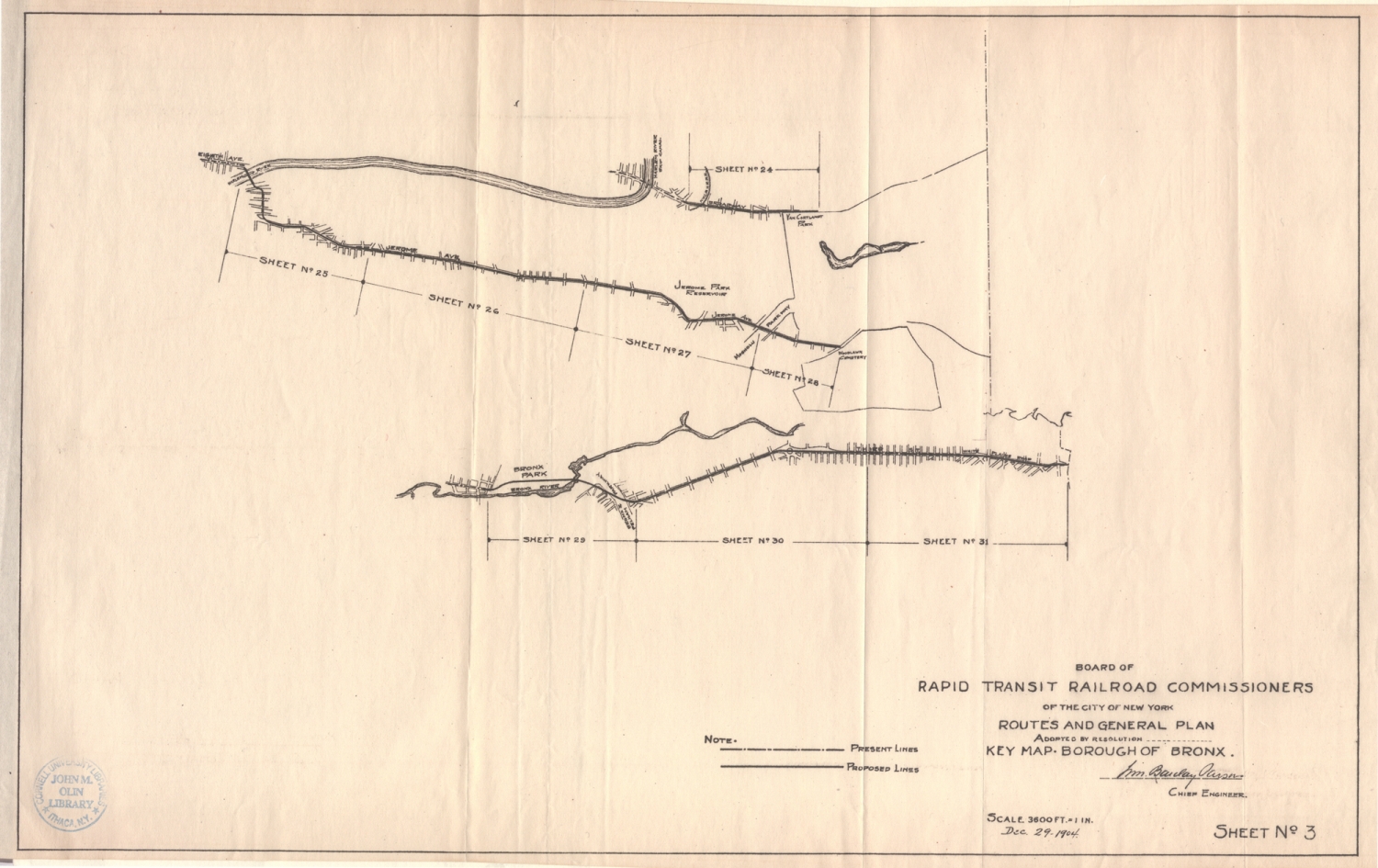
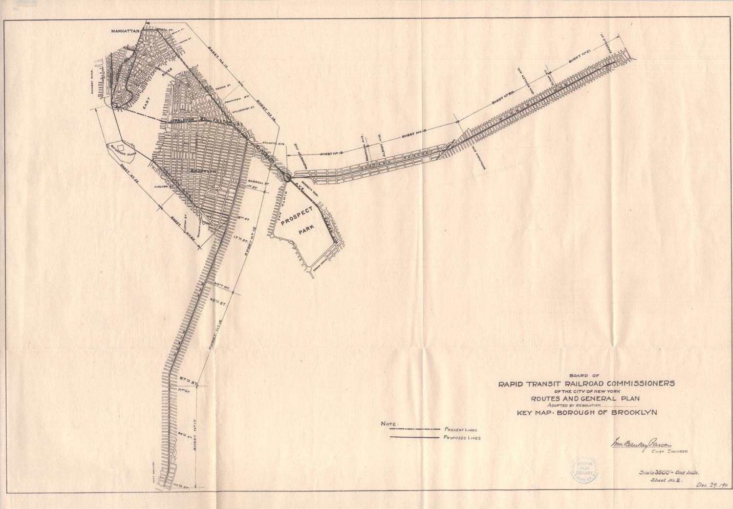
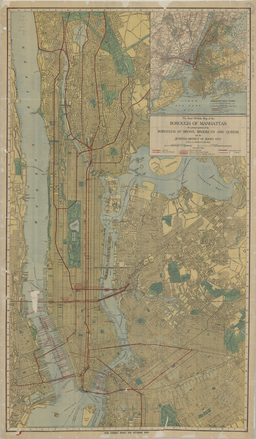
Libraries and Hours Ask a Librarian

Olin & Uris Libraries

Olin: Open until 6pm
Uris: Open until 5pm

Transit Maps

As artifacts, the maps in this section provide frames of reference for understanding planning practice, including underlying assumptions and methods of simplifying and communicating both existing and proposed changes to transportation systems to address the needs of the specific audience for which they were intended. Some of them can also be viewed as works of art—for their aesthetic values and for the methods and technologies associated with particular eras of printing and cartography.

The Rapid Transit Act of 1894 created a Board of Rapid Transit Railroad Commissioners (BRTRC), which was empowered to oversee the development of a rapid transit system in New York City. On October 27, 1904 the subway opened for service between City Hall and 145th Street, a distance of 9 miles. BRTRC determined that expansion of the railways “is necessary for the interests of the public and of the city”, and in December 1904 proposed, that the transit system should be extended to the Bronx and Brooklyn. The three maps displayed below accompany the report of the Board, dated 29 December 1904.

The very first Rand McNally map, created using a new cost-saving wax engraving method, appeared in the December 1872 edition of its Railroad Guide. Their first road map, the New Automobile Road Map of New York City & Vicinity, was published in 1904. In 1910, the company acquired the line of Photo-Auto Guides from G.S. Chapin, which provided photographs of routes and intersections with directions. In 1913 they published this map of Manhattan, the Bronx, Brooklyn, Queens, and the business district of Jersey City. The map includes inset of “Greater New York,” in 1:250,000 scale. The verso includes street indexes: Manhattan and part of the Bronx, Brooklyn and part of Queens, as well as Jersey City and Hoboken.

Rapid Transit Map of Greater New York, 1933
Rapid Transit Map of Greater New York. New York: George J. Nostrand, [1933?]. Cornell University Library Collection.

George J. Nostrand, a New York City lithographer and map publisher, may have acquired the design from the Ohman Map Company (the copyright statement lists Ohman as the holder.) The map was probably distributed as a promotional item as evident from the advertisement in the top right corner. The map shows house numbers at each station. It is oriented with north toward the upper left.

Only thumbnail image is available of this map due to copyright restrictions. The map can be viewed in the Map Room, Olin Library.
Map of New York Subway Elevated Lines, 1955
Map of New York Subways, Elevated Lines. 1:47,520. New York: Hagstrom Company, [1955?]. Cornell University Library Collection.

Hagstrom Map Company, was the best-selling brand of road maps in the New York City metropolitan area in the 20th and early 21st century. The New York Times in 2002 described Hagstrom’s Five Borough Atlas as New York City’s “map of record” for the previous 60 years. From 1941 to 2002, all of Hagstrom’s New York City maps were based on a single master map that was updated by hand. This produced a number of other visual artifacts; new streets and neighborhoods had to be shoehorned into layouts designed around previously existing features.

Only thumbnail image is available of this map due to copyright restrictions. The map can be viewed in the Map Room, Olin Library.


New York Subway Guide, 1972 - View 2
New York Subway Guide. New York: New York City Transit Authority, c1972. Cornell University Library Collection.

This is a revised map of the rapid transit facilities of New York City Transit Authority. It includes route and schedule information. The front features Manhattan, and the verso, the Bronx, Queen and Brooklyn. The individual route schedules are located on the verso. For most of the nineteen-seventies, the official route map of the New York City subway system was a beautiful thing. In fact, it was more than beautiful: it was a nearly canonical piece of abstract graphic design, the work of the celebrated modernist designer Massimo Vignelli, who decided that the only way to make the spaghetti tangle of subway lines comprehensible on paper was to straighten them out. Vignelli’s modernist design stressed visual clarity over geographical precision: on his map, subway lines were enticing ribbons of color that ran straight up, straight down, or at a perfect forty-five degree diagonal; also, the rectangular Central Park was rendered as a square.

Only thumbnail image is available of this map due to copyright restrictions. The map can be viewed in the Map Room, Olin Library.